As India and China continue diplomatic negotiations to de-escalate border tensions, recent satellite images reviewed by India Today show the rapid development of a Chinese settlement near the north bank of Pangong Tso Lake. This settlement is located approximately 38 kilometers east of one of the standoff points from the 2020 border clash between Indian and Chinese forces, although it remains outside India's territorial claims.
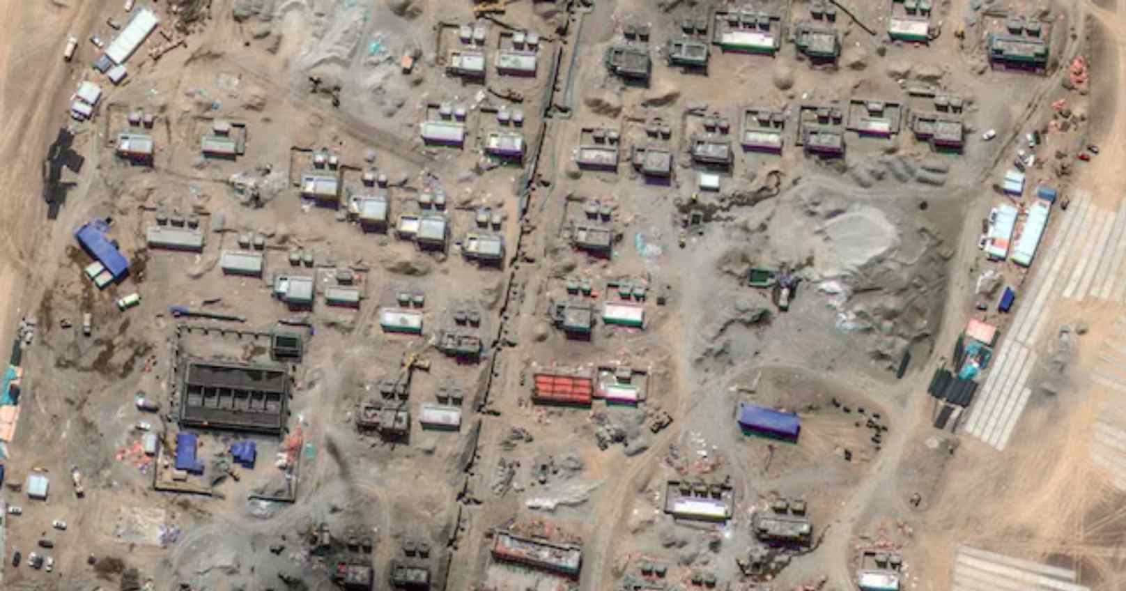
Captured by Maxar Technologies on October 9, the images reveal large-scale construction over an area of about 17 hectares. The site, situated near Yemagou Road at an elevation of 4,347 meters, is buzzing with construction activity, with more than 100 buildings, including residential and administrative structures, being built, according to Y Nithiyanandam, Head of the Geospatial Research Programme at Takshashila Institution. Open spaces and land flattening at the site suggest future infrastructure, possibly parks or sports facilities. A 150-meter-long strip is speculated to be intended for helicopter operations.
Construction began in early April 2024, and the settlement is divided into two sections, likely distinguishing between operational and administrative zones, according to military sources. Structures range from single-story to double-story buildings, with smaller hutments likely housing six to eight people. The design, in staggered rows, aims to reduce exposure to long-range strikes. Additionally, the site’s location behind high peaks provides a strategic advantage, limiting visibility from surveillance equipment.
While some military experts speculate the settlement could serve as an "ad-hoc forward base" for Chinese forces, Nature Desai, an observer of the Indo-Tibetan frontier, suggests it could be intended for Tibetan nomads. Desai notes that the site, identified as Changzun Nuru, aligns with China’s longstanding efforts to settle Tibetan nomads permanently, rather than as a border defense village.
The settlement’s proximity to a water source likely solves any water supply issues, but energy needs will likely be met through renewable sources. Despite the harsh weather conditions expected in the coming months, the pace of construction suggests that many buildings are near completion, marking significant progress over the past six months.